MAJOR PROJECTS EXECUTED
Village Information System
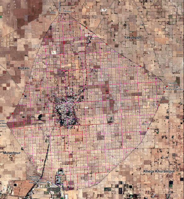
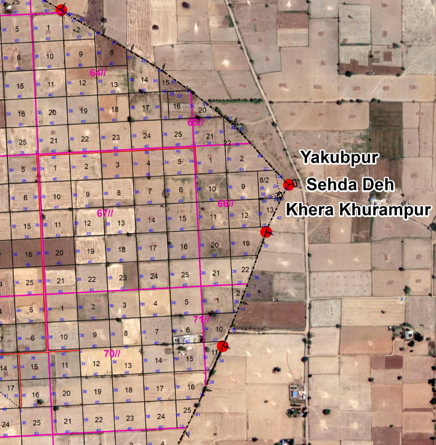
The objective of this project was to develop an information system for 10 villages situated in Faridabad Block of Faridabad District (Haryana) with the help of GIS and GPS technologies. Mapping of each village was done on 1:1000 scale using GPS survey and cadastral maps. Extensive Field Survey was conducted for the collection of attributes related information and marking of facilities as waypoints as per the village information data model. And later on a decision support system was generated with the help of a customized GIS engine that can be supportable for the planners and decision makers to retrieve the information by integrating the spatial and non-spatial data for that area. With the help of this system planners and decision makers can get spatial and non-spatial data for optimal interpretation.
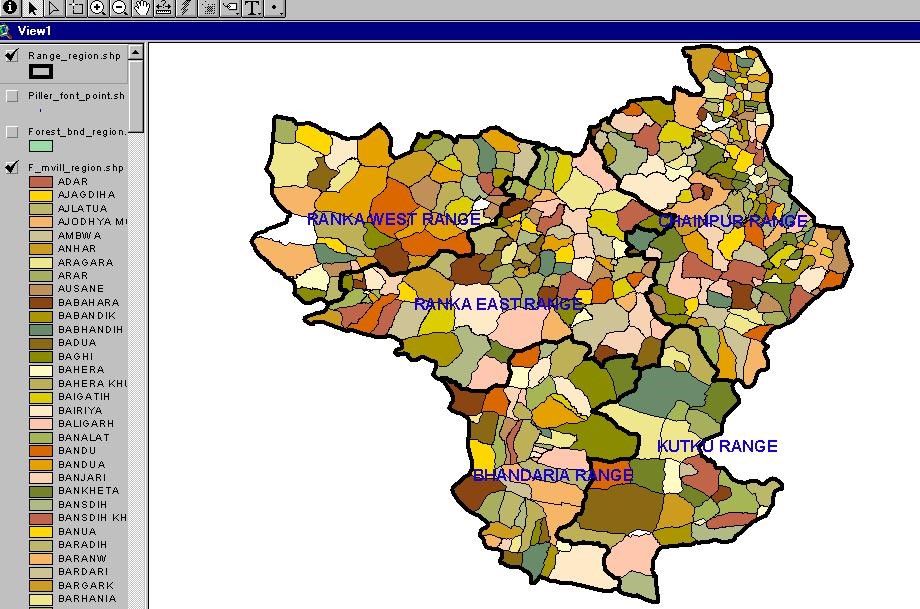
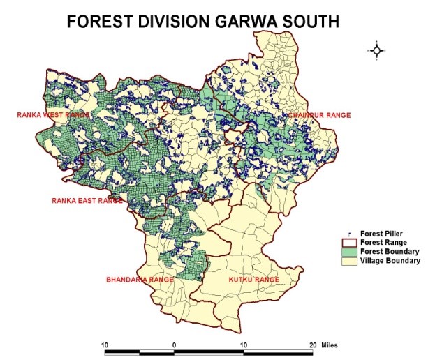
Forest/Vegitational Change Detection for Garwa South Forest Division (Jharkhand)
The processing of satellite imagery and its analysis in GIS has provided a useful method for assessing Vegetation Change Detection. In this project change detection study has been done on the forest of Garwa Range using the latest technology of Remote Sensing and GIS. This study has been done using Remote Sensing data IRS 1C LISS- III, IRS 1C PAN, and SOI topographic sheets surveyed in 1978-79, Forest Division map provided by forest department, and village revenue (mussavis) maps. Finally using all these data and doing change detection analysis through overlay of thematic maps and filtering out the zones of forest degradation it was found out that there is a change in vegetation area in the forest.
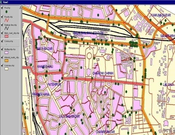
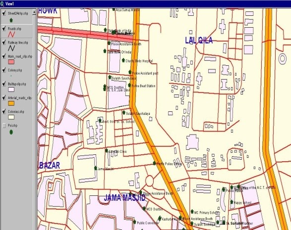
Public and Semi-public Social Infrastructure Mapping and Analysis
The main objective of this project was to setup an "Information kiosks" that will guide the tourists regarding the locations of public facilities available in Chandani Chowk constitutional area of Delhi State. So the location based Mapping of public facilities on 1:2500 scale was done using EICHER maps and Field Survey with GPS. Extensive Field Survey was conducted for the collection of attributes related information and marking of facilities as waypoints as per the utility data model. Information processed and GIS ready maps were prepared for creation, updating and maintenance of public facilities and amenities situated in Chandani Chowk constitutional area.
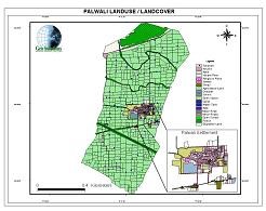
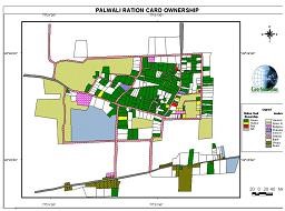
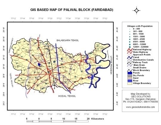
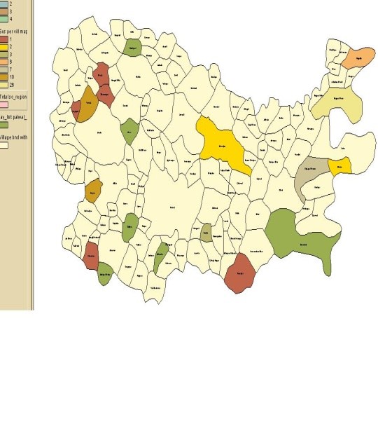
GIS As a Decision Support System at Block Level (A pilot study of Palwal Block (124 Villages), Faridabad)
The objective of the project was to demonstrate the applications of GIS technology for the development of Decision Support System (DSS) for the local administrators for the betterment of their region. The Palwal Block of Faridabad District (Haryana) was selected for the pilot study area covering 124 villages.
The database from 2004 -2005 of various rural development schemes like SGRY, SGSY, IAY, MPLADS etc have been collected from office of Additional Deputy Commissioner and analyzed using GIS software. Intervention and gap areas identified through analysis and displayed through thematic maps.
Various other Maps showing population analysis at village level, transportation facilities analysis (approach roads to National Highways, railway track etc.) and irrigation facilities analysis (major to minor canals) at Block level have also been generated. The study was very successful and has been highly appreciated by the local administration.
Development of Village/Panchayat level Integrated Spatial Database on Natural Resources and Socio-economic parameters using GIS, GPS & RS technologies to help in Local Area Developmental Planning
The village Chharora had been selected for the pilot study, situated in tehsil and development block, Tauru of the newly created district namely Mewat which was earlier a part of district Gurgaon (Haryana).
Geo Solutions has completed the above-mentioned project, which was jointly implemented by NISTADS and Geo Solutions, sponsored by NRDMS Division, Department of Science and Technology, Govt. of India.
The objective of the project was to develop an Integrated Village Information System that will be adopted through a holistic approach wherein all the sectors viz. economic (primary, secondary and tertiary), socio-cultural (customs, tradition, knowledge, attitude, behavior and practice), infrastructural- social (educational, health and recreational activities) and physical (water, electricity, roads and streets, solid and liquid waste management), land-use (built up area, agricultural field and forest land) will be understood carefully at the grass-root level and spatial and non-spatial database of each sector will be analyzed with the help of geo-spatial technologies to find out intervention and gap areas.
The data had been used from various sources, particularly high-resolution satellite data (at present Q. B. Imagery of .61cm resolution), handheld GPS, field survey data and other secondary data.
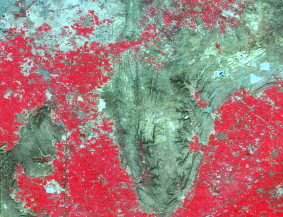
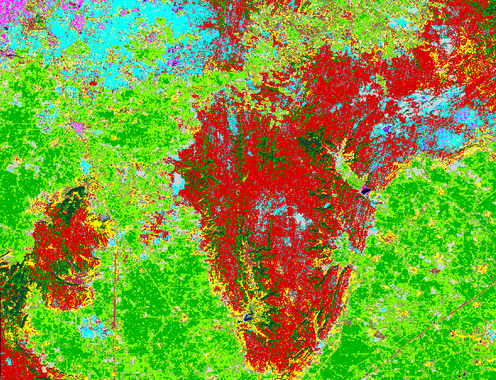
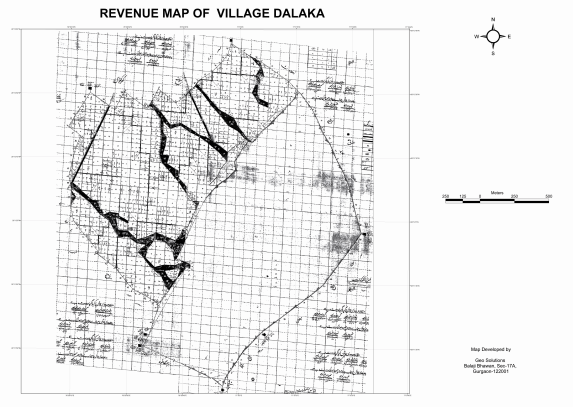
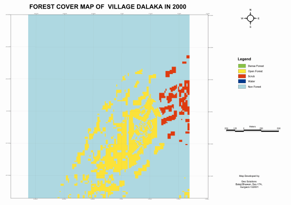
Mapping and Vegetation Change Detection of Forest Areas of Gurgaon & Mewat Forest Divisions (Using PAN & LISS-III Images) of Haryana State on Geo-Referenced Revenue Maps
Under this project 50 villages form Gurgaon Forest Division and 114 villages from Mewat Forest Division have been selected where plantation under Aravali project had been carried out.
After geo-correction of village revenue maps, present status of forest cover was to be marked as forest plantation, percentage of encroached area under settlement, agriculture, mining and non-forest area, using the latest technology of Remote Sensing and GIS. This study has been completed using Remote Sensing data (IRS 1C LISS- III and Pan of year 2000 & 2004 for change detection) and SOI topographic sheets, and village revenue (Sajra/mussavis) maps.
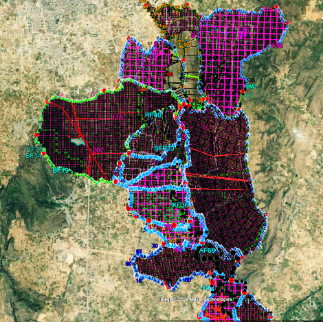
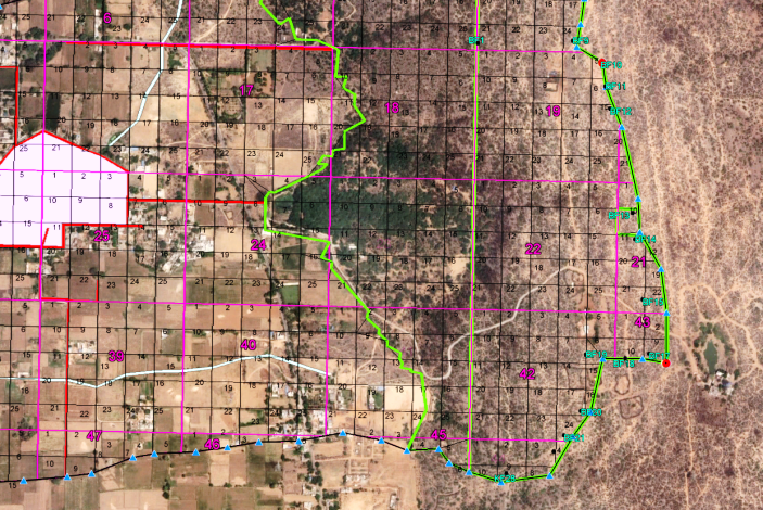
Demarcation of Forest Areas closed under section 4 & 5 PLPA with GIS and GPS technology of Mewat, Gurgaon, Mahendergarh and Rewari Districts of Haryana State
Almost 200 villages from the above said districts of Haryana state had been selected for demarcation of forest area under section 4 & 5 (PLPA). An extensive field survey was carried out to demarcate the exact khasra No of the village forest areas as per the revenue record. Later on village revenue map (Cadastral/Sazra) of each village was also geo-referenced with the help of High resolution satellite image. The project submitted with good appreciation from forest & revenue department officials.
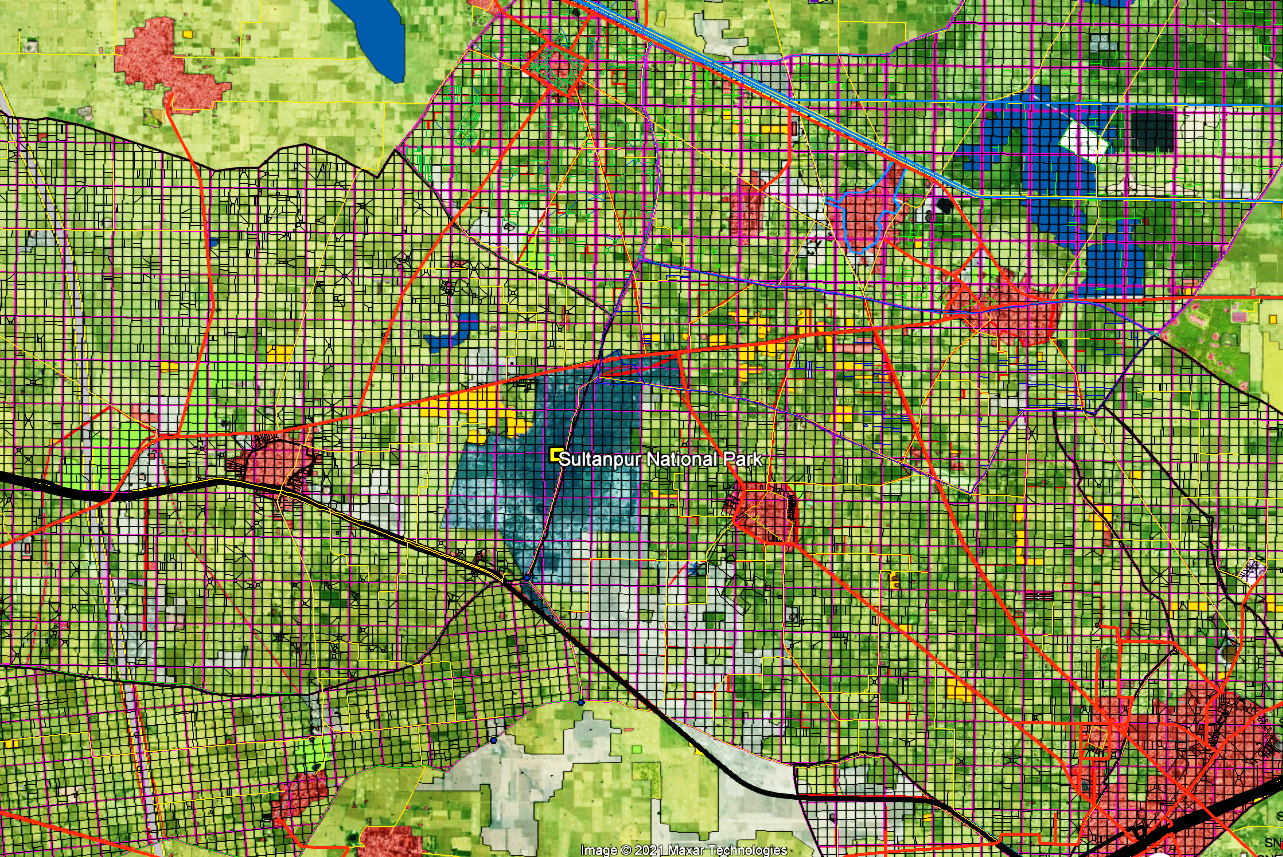
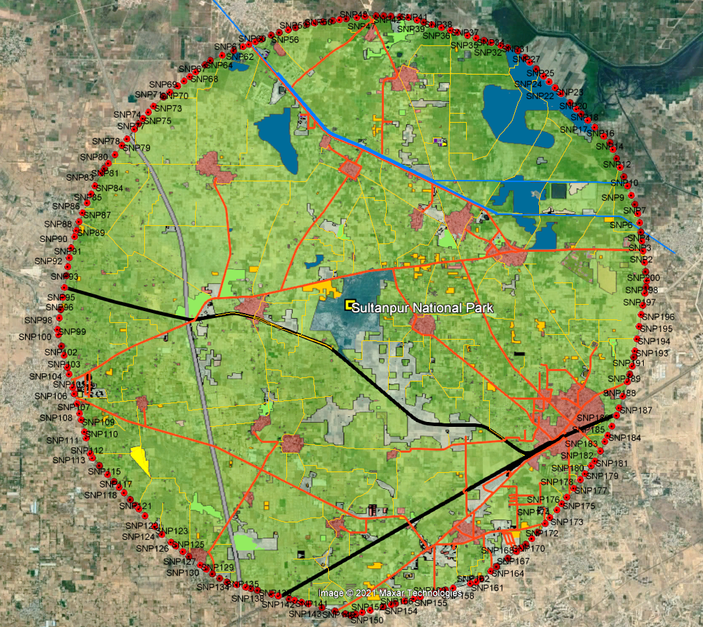
Geo-informatics & Surveying Techniques based Demarcation of Sultanpur National Park Zone, Gurgaon, Haryana.
This project has been awarded from Forest Department Gurgaon for demarcation of 5 kms Eco-sensitive Zone of Sultanpur National Park, Sultanpur, Gurgaon. 23 villages are lying within the catchment area of the Sultanpur Lake, where the zoning would be done as per their requirement. The revenue maps of each village will be geo-referenced, digitized and the exact khasra no will be marked on the ground for the different zones.
Landuse/Landcover Mapping of Eco-Sensitive Zone up to 5kms from the premiership of Sultanpur National Park, Gurgaon, Haryana.
This project has been awarded from Forest Department Gurgaon for Landuse/Landcover mapping of Eco-sensitive Zone up to 5 kms from the premiership of Sultanpur National Park, Sultanpur, Gurgaon. High resolution satellite data (Q.B.) has been used for classifying and exacting the individual feature class using EARDAS Imagine & Arc GIS software as per the requirement of Forest Department.
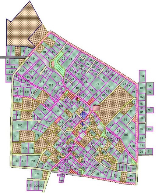
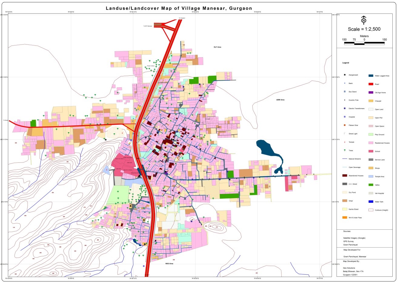
GIS Based Village House Hold, Infrastructure and Agriculture land Mapping of Manesar Village, District Gurgaon, Haryana
The village Manesar is well known for its Industrial Model Township (IMT Manesar) and had been selected for the pilot study covering an objective of house hold and infrastructure level planning in the village in consultation with the district authorities (Deputy Commissioner, DDPO, BDPO, Gurgaon).
Geo Solutions completed the project with high appreciation from the concerned authorities providing them full landuse/landcover mapping of Manesar Village showing all the physical & social infrastructure, house hold level mapping at 1: 1000 Scale with contours and 3D Model to evaluate the current status of the infrastructure of the village.
Updation, Position Correction and Migration of DWG & DNG files into Geo-Database of Sharjah City of UAE
We have done this project for Ericson India. The broad scope of the project was migration of DGW & DNG files into Geo-database covering major features of Sharjah city i.e. roads, built-up area and landmarks and their position correction and updation. We systematically categorized, managed and updated the database in GIS platform using MapInfo and Arc GIS softwares and successfully delivered the project within the stipulated time.
Preparation of Key Plan/Base map, Property Tax & Household Mapping, Topographic Survey of Unauthorized Colonies, Digital Shajra Preparation and MC Land Demarcation
Department of Urban Local Bodies, Govt. of Haryana
Project Areas:
- Gurgaon District: Sohna, Farukhnagar, Hailymandi Municipalities
- Mewat District: Nuh, Tauru, Firojpur Jhirka, Punhana Municipalities
- Palwal District: Hathin & Hodal Municipal Councils
- Mahendergarh District: Narnaul Municipal Council
- Sonipat District: Gohana Municipal Council
- Rohtak DIstrict: Sampla Municipal Council
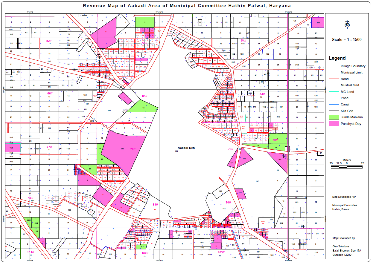
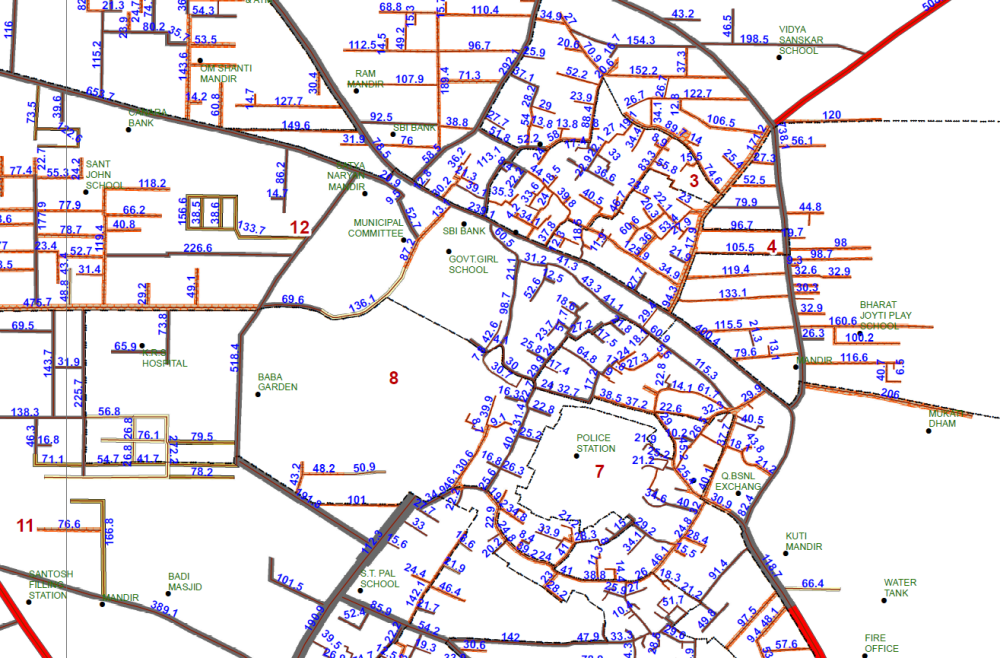
Property tax and House Hold Mapping − MC Sohna & MC Hathin
Preparation Base Map/Key Plan, Digital Shajra and MC Land Demarcation − MC Sohna, Farukhnagar, Haily Mandi, Tauru, Nuh, F. Jhirka, Punhana, Hathin, Narnaul, Gohana, Sampla, Ladwa
Utility (Sewage, Power & Drinking Water) Network Mapping- MC Sohna, Farukhnagar, Haily Mandi, Tauru, Nuh, F. Jhirka, Punhana, Hathin, Narnaul, Gohana, Sampla, Ladwa
Preparation of Base Map/Key Plan, Digital Shajra with 1m Contour Interval − MC Narnaul & MC Sohna
Demarcation of Revenue Land for Different Stakeholders
Geo-spatial Technologies covering Differential Global Positioning System (DGPS), Geographical Information Systems (GIS) and Remote Sensing (RS) and Electronic Total Station (ETS) survey which are highly accurate combination of technologies and capable to provide accuracy in inches, have been used for demarcating the revenue land for different agencies, where land disputes were existing and demarcation was not feasible by the traditional method of revenue department. Hence, we had been appointed by various Govt. and private agencies to resolve the issue of land demarcation. The list covers:
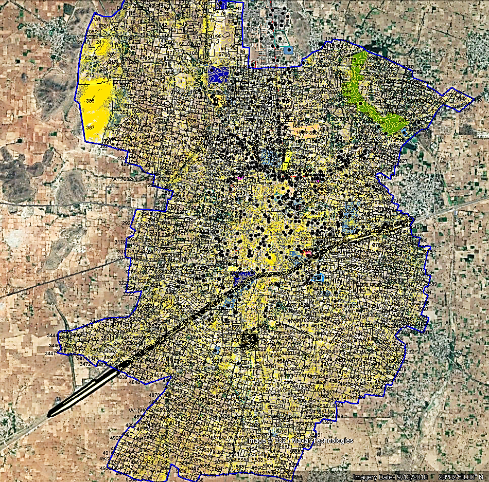
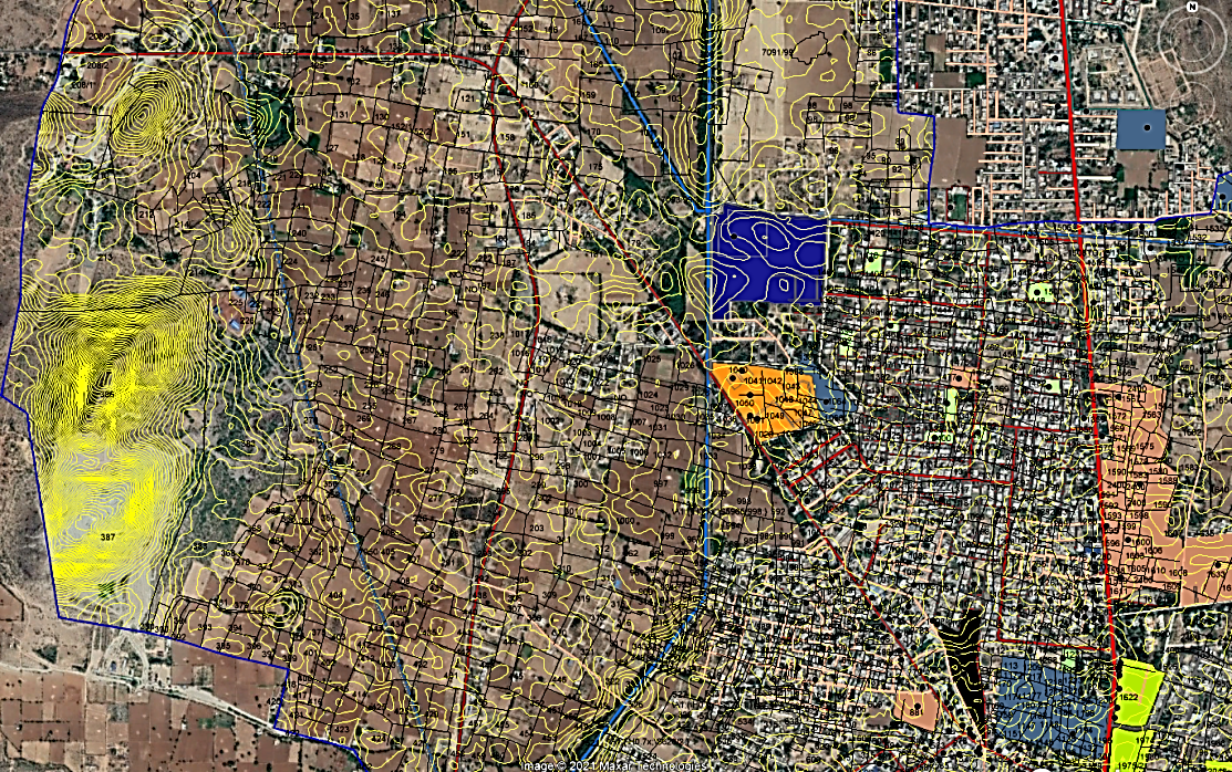
The modern tools and technology i.e. Drones, DGPS and GIS platforms are being used and villages of whole India are to be mapped. The processing is in continuation and Geo Solutions feels privileged to be part of this project and continuously working for project areas. Currently, we are working at the villages of Municipal Council Sohna, Gurugram.
The scheme aims to provide an integrated property validation solution for rural India. The demarcation of rural abadi areas would be done using Drone Surveying technology. This would provide the ‘record of rights’ to village household owners possessing houses in inhabited rural areas in villages which, in turn, would enable them to use their property as a financial asset for taking loans and other financial benefits from Bank
- Department of Forests, Govt. of Haryana
- Urban Local Bodies, Govt. of Haryana
- Department of Rural Development & Panchayats, Govt. of Haryana
- Provided Solutions to more than 200 village Panchayats
- Central Industries Security Forces (CISF) Land, Govt. of India
- Major Private Colonizers
- DLF, EMMAR, PARAS Buildtech, M3M, AIPL, ROF, Mayar etc.
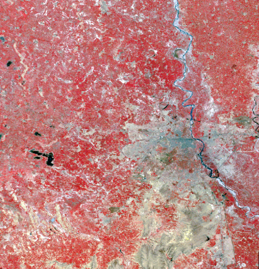
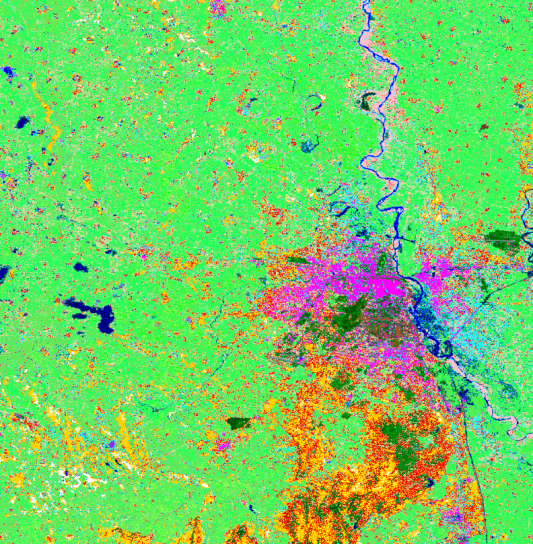
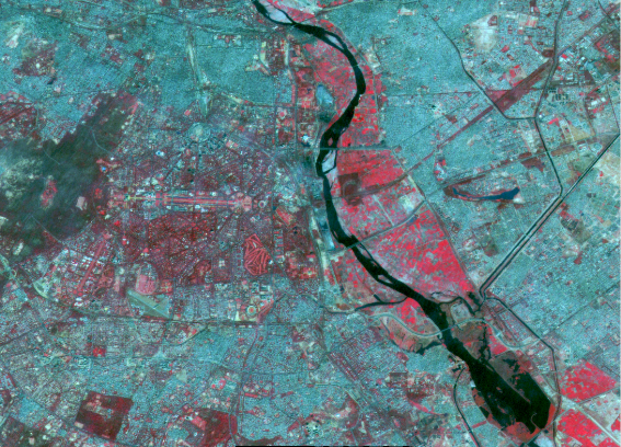
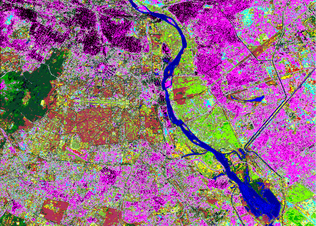
Landuse/Landcover Mapping of NCT Delhi
This project had been awarded from Assistant Inspector General of Forest, Ministry of Environment and Forest, Govt. of India in 2008-09 under the project entitled "The Trend of vegetation cover in NCT Delhi and its effect on the thermal environment". Geo Solutions applied the digital image processing techniques and classified various types of satellite data i.e. IRS LISS-3, ASTER, Landsat MSS, Thematic Mapper and Enhanced Thematic Mapper in combination with field validation of entire NCT Delhi area of 1484 Sq. Km. We used ERDAS Imagine software for supervised and unsupervised classification and GPS for field verification. Survey of India (SOI) topographic sheets of the entire area had been scanned and geo-rectified and had been used for the dereferencing of the satellite images.