CURRENT PROJECTS
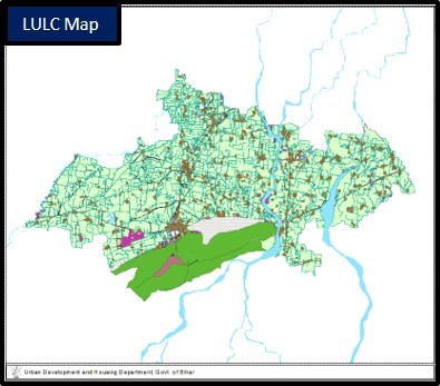
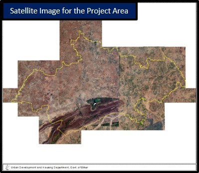
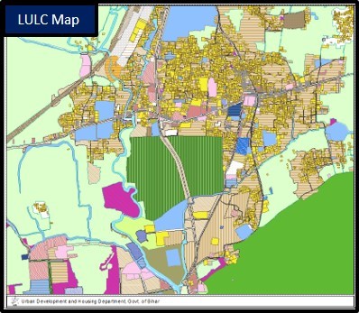
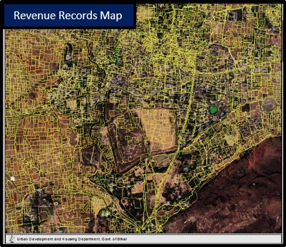
Preparation of Base Map and Landuse Map for Rajgir Regional Planning Area, Nalanda, Bihar using GIS Platform
The project is based on AMRUT standards, therefore based on hybrid approach, which includes satellite data processing, DGPS survey, Landuse/Landcover extraction, Building type/use Survey, Street mapping which will be resulted as:
- Digital Revenue Records (Kharsa) transformation to a GIS platform with Landuse Register as excel table
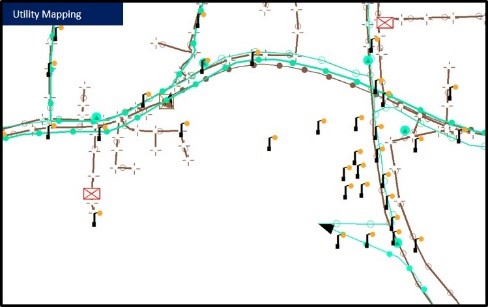
- Existing Utilities: Water, Sewage System, Power Network
- Exiting Landuse/Landcover mapping
- Existing Building & Land Parcel type/use
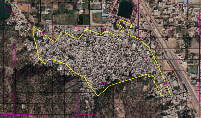
The project covers an area of 400 Sq. Km that comprises 157 villages and 02 towns. A detailed physical survey conducted on ground and the satellite data was processed, the following steps have been covered:
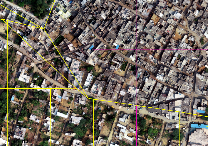
- Collected 680 DGPS points for Cadastral Map Registration and Satellite Image Registration (400 Sq Km Area)
- Generated contours from the DEM processed by Stereo pairs.
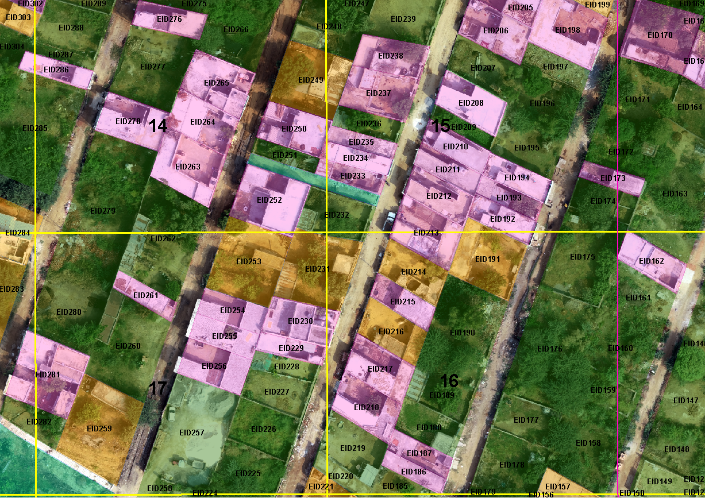
- Building type/use Survey & Mapping (2,84,000 Surveyed and mapped)
- Mapped all utility networks i.e. Sewage Network, Drinking Water Network, Power Network.
SVAMITVA SCHEME - "Survey and Mapping of Abadi Areas of Villages with Improvised Technologies"
SWAMITVA is a Central Sector scheme launched by Hon’ble Prime Minister of India on National Panchayat Day i.e. 24th April 2020. The Ministry of Panchayati Raj (MoPR) is the Nodal Ministry for implementation of the scheme. In the States, the Revenue Department / Land Records Department will be the Nodal Department and shall carry out the scheme with support of State Panchayati Raj Department. Survey of India shall work as the technology partner for implementation.
The modern tools and technology i.e. Drones, DGPS and GIS platforms are being used and villages of whole India are to be mapped. The processing is in continuation and Geo Solutions feels privileged to be part of this project and continuously working for project areas. Currently, we are working at the villages of Municipal Council Sohna, Gurugram.
The scheme aims to provide an integrated property validation solution for rural India. The demarcation of rural abadi areas would be done using Drone Surveying technology. This would provide the ’record of rights‘ to village household owners possessing houses in inhabited rural areas in villages which, in turn, would enable them to use their property as a financial asset for taking loans and other financial benefits from Bank