We’re here to evolve with the latest tech and involve you in the process. Whether it’s drone surveys or smart mapping solutions, we keep you ahead of the curve. Let’s create value together.
AMRUT Standards | Urban Master Plan Standards | Smart Cities Standards
CMMI L3 Certification | ISO/ICE 27001:2022 – Information Security Management System (ISMS) | ISO 9001:2015 – Quality Management System | Start Up India | MSME


“Bridging the Gap Between Idea and Execution”

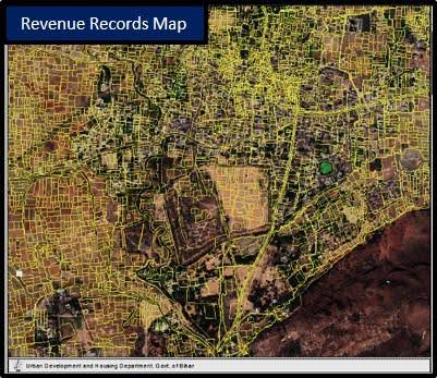
Revenue Map
A Revenue Record Map GIS digitally maps land ownership, integrating data for accurate land management, dispute resolution, and informed decision-making.

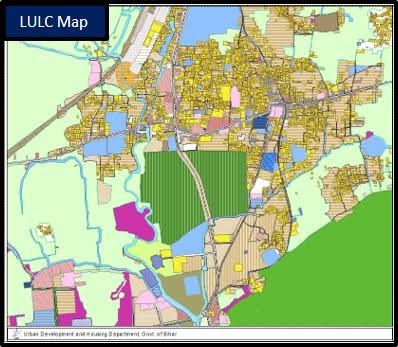
LULC Map
A LULC Map GIS shows land use and cover, aiding in environmental monitoring, urban planning, resource management, and policy-making.

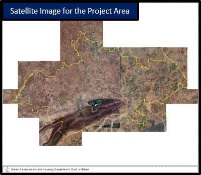
Satellite Imagery
Satellite imagery captures high-resolution photos of Earth, crucial for environmental monitoring, urban planning, agriculture, disaster management, and military surveillance.

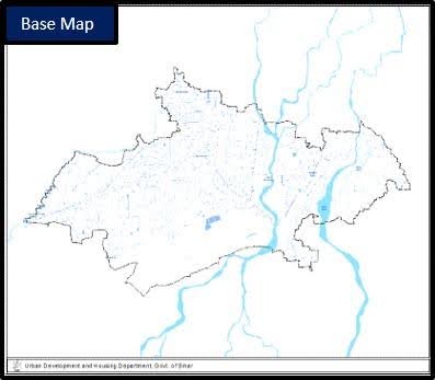
Base Map
A basemap GIS offers essential geographic data, supporting spatial analysis and visualization by providing foundational layers for diverse applications.
With over 15 years of expertise, Geo Solutions India leads with innovation and adapts to new technology trends, ensuring you’re always ahead of the curve. Our “Evolve & Involve” approach means we focus on collaboration and real-time feedback, guaranteeing better outcomes.
We specialize in geospatial solutions—drone surveys, DGPS, and advanced mapping—serving sectors like urban planning, utilities, and land management. Our H2H (Human to Human) philosophy ensures a personal touch, making technology easy to integrate while delivering tangible results and strong returns on investment.
From land demarcation to basemap creation, we simplify complex processes so you can focus on what matters most—your goals.
Unlock the power of geospatial solutions with our core services.
Clear, accurate boundaries that enhance transparency and streamline land and revenue management.
Capturing precise data through cutting-edge tools like drones and DGPS for reliable, accurate spatial data.
Transform raw data into usable formats, providing clearer insights and better decision-making.
In-depth data analysis to uncover trends and create predictive models for strategic planning.
“Promotion and Propagation of Technologies and Ensuring ROI“
From land management to infrastructure development, we offer end-to-end geospatial solutions across industries.
Delivering clear, precise land boundaries and transparent revenue records to streamline management and compliance.
Empowering smart city development with advanced mapping and data solutions to tackle modern urban challenges efficiently.
Proactive solutions for disaster preparedness, response, and recovery, leveraging geospatial technology to protect lives and property.
Offering precise geospatial tools to enhance land management, optimize crop production, and support real estate development.
Meet the people behind our success—innovators, leaders, and friendly faces you can trust.

CEO
Specialist in GIS, GPS, and Remote Sensing with over 20 years of experience in geospatial technologies.

COO, CTO
Over 20 years in Defense & Civil sectors, excelling in Agile product solutions and project management.

Chief Advisor (R&D)
18 years in industry and academia with multiple international research publications and professional achievements.
See how we’re transforming landscapes with smart geospatial solutions! From precise land mapping to advanced infrastructure planning, our work speaks for itself. Each project is a new opportunity to innovate, streamline processes, and help you achieve your goals faster. Whether it’s drone surveys, 3D modeling, or land management— we’ve got you covered. Let’s turn your vision into reality!
 by INKANDBLINK